


Increasingly earlier, more intense and devastating, atlantic hurricanes, fuelled by steadily rising ocean temperatures, are becoming ever more dangerous and unpredictable. So much so that some scientists have suggested adding a new category 6 to the scale that measures their intensity. The latest example of this alarming trend is Hurricane Beryl , which is scourging the coasts of Texas and Louisiana, causing deaths (8 at the time of publication of this article) and leaving 2.6 million people without electricity. And this may only be the beginning --the hurricane season will last until 30 November and Beryl is the earliest Category 5 hurricane ever to appear in the Atlantic Ocean.
The warming of the Atlantic and the evolution of storms
On 28 June, Beryl was just a tropical depression, with winds of 56 km/h. Over the following 48 hours it rapidly intensified, becoming the first category 4 hurricane to form in June. After reaching winds of 250 km/h, Beryl began making landfall on a number of islands in the Caribbean Sea, including Jamaica and Cayman, astounding the scientific community with its precociousness.
‘Category 5 hurricanes are more frequent in August and September,’ Enrico Scoccimarro, a scientist at the Euro-Mediterranean Centre on Climate Change (CMCC), tells Renewable Matter. "The precocity of Hurricane Beryl is mainly linked to the strong warm anomaly underway in the Atlantic Ocean, where temperatures above 29°C have been recorded to date. We see a trend towards an extension of the warm period in the Atlantic Ocean and therefore the intensification of storms becomes more likely in these months”. Tropical storms acquire most of their energy from the ocean through evaporation. That is why the hurricane season in the North Atlantic runs from June to November, the time of year when the water is warmest.
This year's hurricane season promises to be particularly intense. According to forecasts by the National Oceanic and Atmospheric Administration (NOAA), published in May 2024, hurricane activity in the Atlantic basin is expected to be 85 per cent ‘above normal’, ranging from 17 to 25 storms in total. Of these, 8 to 13 are expected to become hurricanes (with wind speeds reaching over 110 km/h). For NOAA experts, the exceptionality is due to a confluence of various factors, including near-record warm ocean temperatures in the Atlantic Ocean and the climatic phenomenon called La Niña, whose effect on the Atlantic is a reduction in trade winds and wind shear (or wind gradient, the difference in wind speed between different vertical levels in the atmosphere), facilitating the genesis of tropical cyclones.

Hurricanes ‘grow’ faster
Last autumn, a study published in the journal Scientific Reports found that Atlantic hurricanes between 2001 and 2020 were twice as likely to evolve from a weak storm to a category 3 hurricane or higher within 24 hours, compared to those from 1971 to 1990. Strong, rapidly developing hurricanes are therefore becoming more and more likely, according to the data. And a hurricane that intensifies more quickly may also be more dangerous because it allows less time for people in areas expected to be affected to prepare and evacuate.
However, global warming caused by greenhouse gas emissions may not be the only factor contributing to the warming of the North Atlantic and the change in hurricane behaviour. According to a study published in the American Meteorological Society, decreasing aerosol pollution may also have influenced storm patterns. By scattering, reflecting or absorbing sunlight, aerosol particles reduce the amount of solar radiation reaching the lower layers of our atmosphere, slightly cooling the planet. Research published in the journal Science Advances calculated that, over the past four decades, a 50 per cent decrease in aerosols in North America and Europe has led to a 33 per cent increase in the number of tropical cyclones in the North Atlantic.
The proposal for a category 6 for hurricanes
The hurricane categories, ranging from 1 to 5, are determined by the wind speed of a storm. They are all dangerous, but storms of category 3 or higher – with wind speeds greater than 180 km/h – are considered ‘major hurricanes’.
The metric to globally classify the power of a hurricane dates back to 1974 and is called the Saffir-Simpson metric. According to scientists Michael Wehner, of the Lawrence Berkeley National Laboratory, and James Kossin, of the First Street Foundation, a non-profit climate organisation, this scale is inadequate today. After all, there is a big difference between the impact of Hurricane Patricia, whose winds reached 346 km/h in 2015, and that of Hurricane Lee, which peaked at 258 km/h last September. But by the Saffir-Simpson scale parameters, both hurricanes were classified as Category 5.
In February, Wehner and Kossin published a paper in which they propose a category 6 to adequately update the Saffir-Simpson scale. According to the new categorisation, Category 5 hurricanes would touch wind speeds between 240 and 310 km/h. Above 310 km/h, hurricanes would be identified as category 6.
“The Saffir-Simpson scale is based on a very specific parameter to make an assessment of the intensity of a tropical cyclone, i.e. the maximum sustained wind intensity for a period of 1 minute (in the United States National Weather Service definition),” Scoccimarro says. "This indicator does not integrate all the information needed to define the impact of a tropical cyclone. Other metrics are being developed for a more useful characterisation of the phenomenon to support Early Warning systems”. In fact, there are numerous parameters at play that the scale does not consider: size, duration, speed of movement, associated precipitation and the amount of ocean water pushed onto the coast.
From the perspective of early warning systems, although the aforementioned category 6 can now be considered plausible from an energetic point of view, in accordance with the theory of potential cyclone intensity in the current climate, Scoccimarro thinks it is more important to focus on defining indicators that can better prepare the population for possible disasters, therefore going beyond the classic Saffir-Simpson.

This article is also available in Italian / Questo articolo è disponibile anche in italiano
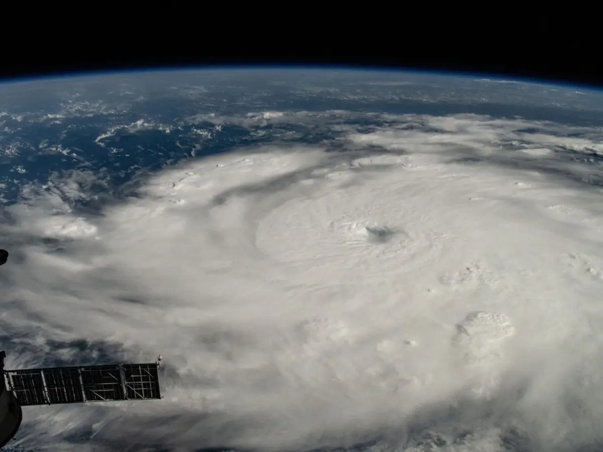
Cover image and above: Beryl photographed by the ISS © NASA